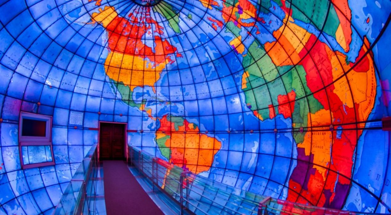
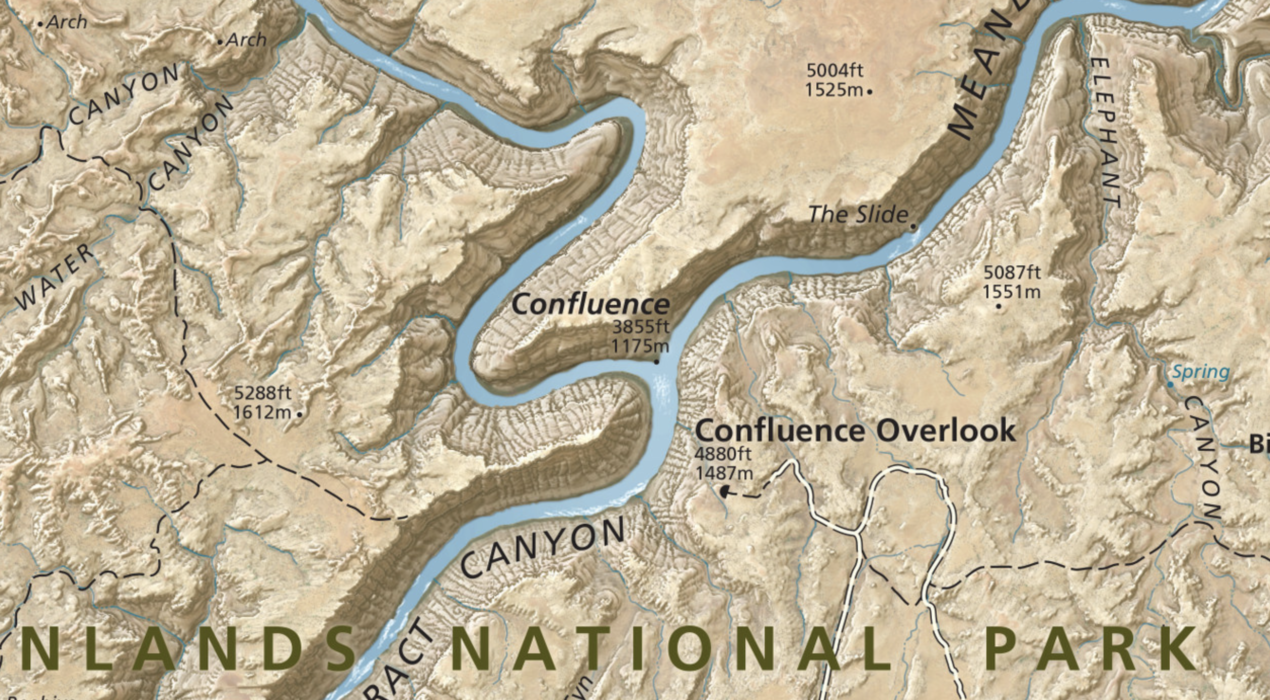
When we look at a globe, the relative sizes of the continents are distorted by perspective — the sphere itself causes different regions to appear distorted because they are at different distances from our eyes. But if we could view the globe from its exact center, looking outward, our eyes would be the same distance from every point on the map. What a remarkable experience that would be…but how would such a thing be possible? Enter the Mapparium to find out! The Mapparium is a three-story-tall, inside-out stained-glass globe with a glass walkway crossing directly in the middle. Check out a short video about it here. It is definitely worth a visit if you are a map geek like me! You can find it in the Mary Baker Eddy Library in Boston, Massachusetts. General admission is $6. No photography is allowed.
Read More ›
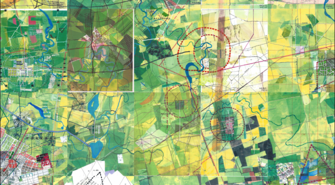
In the summer of 1963, Michigan native Jerry Gretzinger began drawing a map of an imaginary city. He says: “The work started as a doodle done in the spare time I had while working at a tedious job. I continued to add to that map through the years until, in 1983, I set it aside to put my free time to other use. The Map was stored in the attic of our home in Cold Spring, New York. It gathered dust. My son, Henry, found it one day while rummaging around. He brought it down to me and asked what it was. Seeing it then triggered me to dust it off and continue the project. It now comprises over 3200 individual eight by ten inch panels. Its execution, in acrylic, marker, colored pencil, ink, collage, and inkjet print on heavy paper, is dictated by the interplay between an elaborate set of rules and randomly generated instructions.” For the past 50 years, Jerry has been “painting his microcosms on over 2,600 sheets of paper, cataloguing new facilities and landmarks in both a carbon copy-based archival system and a computer spreadsheet, turning towns into cities, cities into metropolises, with no end in site for […]
Read More ›
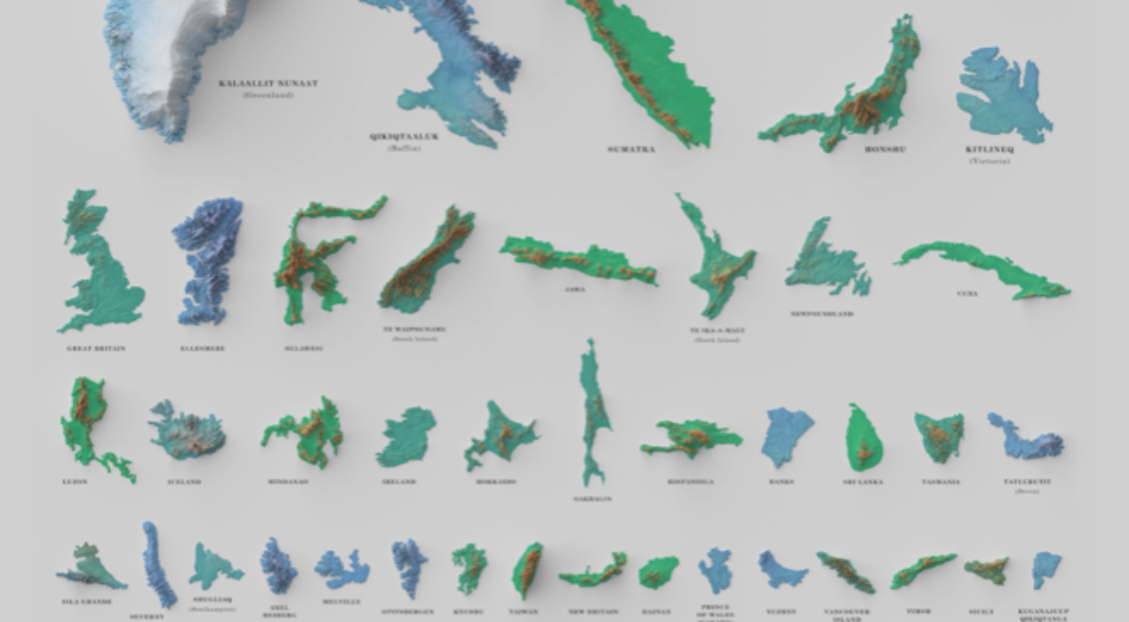
After Typhoon Haiyan swept through the Philippines in 2013, cartographer David Garcia started thinking deeply about islands and how “colonization, crises, conflict and climate change” have been affecting islands there and around the world. “New ones continue to form, and old ones disappear from view, drowned by rising water or other factors.” Garcia often made maps of the largest islands in the Philippines to give to friends and mentors as gifts. His latest project is a collection of the 100 largest islands in the world. It’s a fascinating view to see them together in a single poster, check it out here. [Source: Atlas Obscura]
Read More ›
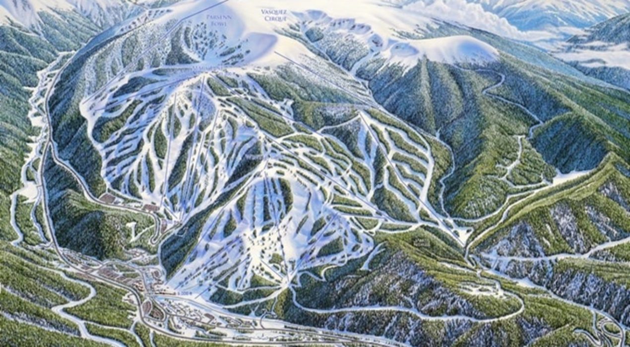
If you’re a powder lover and have skied the big mountains of the American West or Europe, you are probably very familiar with the art of James Niehues. His painstakingly researched and hand-painted maps are featured at ski resorts all over the world from the US to Canada, China, Australia, Chile, Japan, Korea, Scotland, New Zealand and Serbia. The 72-year old Colorado native painted his first map in 1987 and he’s still going strong today. His maps are wildly popular, so much so that a Kickstarter campaign has funded the first-ever coffee table book of his map art, scheduled for release this summer. “In addition to nearly 100 ski resorts from around the globe, this book will include background information on trail map making and an in-depth look in James Niehues’ remarkable career. This project is a celebration of Niehues’ life work and his contribution to the ski industry featuring some of the greatest mountain terrain in the world. His work, build on the foundation of artists the came before him, provides the connective tissue that links together millions of ski memories over the last three decades.” [Source: Kickstarter.com] “I think of the paintings as art instead of trail maps. In the […]
Read More ›
During the government shutdown in 2013, Matt Holly, a ranger with the Natural Resource Stewardship and Science Directorate in Colorado, launched a website that, for the first time ever, made available some 1,053 hi resolution digital maps from all the national parks in our 50 states. The maps are available to view, save and download for free. You can search by state or by park name. In addition to maps of every national park you can also find maps of various national monuments, recreation areas, historic sites, national seashores, lakeshore and rivers. The description of the website states: “NPMaps.com is an independent website and is not affiliated with the National Park Service. This is just a one-man project that gets worked on whenever said guy actually has some free time. It’s hard work!” Thanks, Matt, we truly appreciate it!
Read More ›
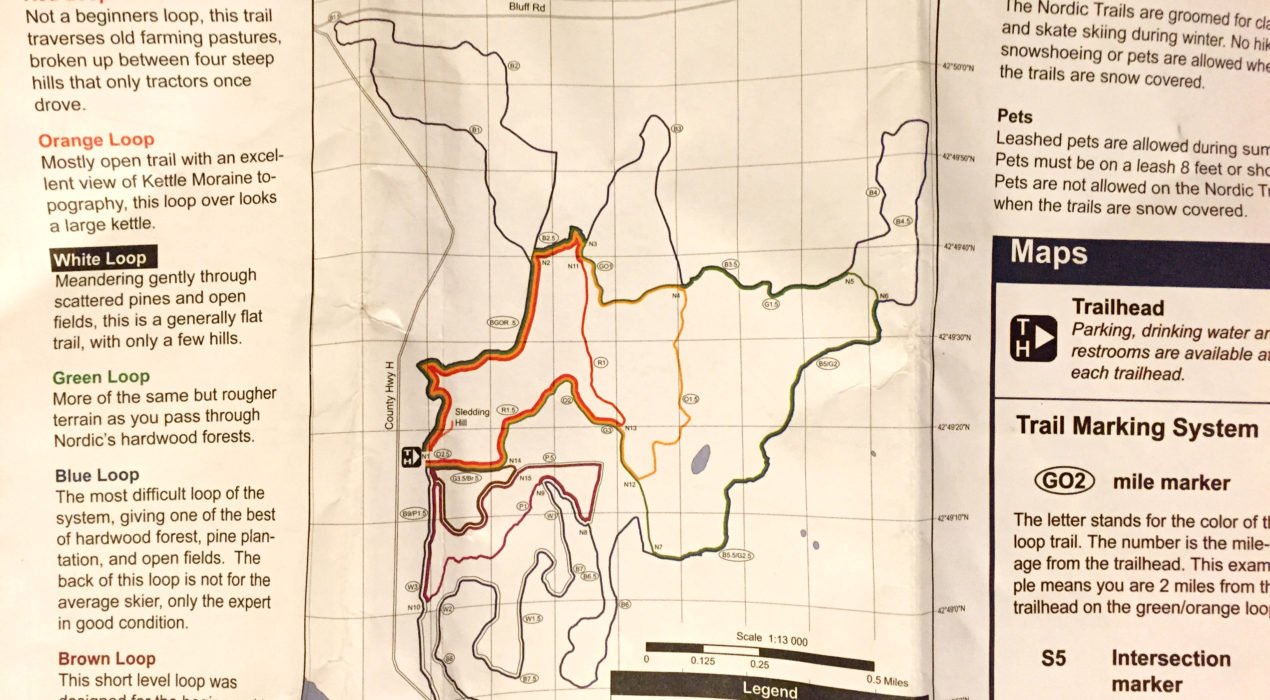
I am an avid hiker and yesterday I took advantage of the sunny and mild weather here in Wisconsin to wander a bit through the Kettle Moraine State Forest (it is very strange and disappointing not to have snow to ski or snowshoe on). So I grabbed this paper map at the ranger hut and hit the trails! As I like to say, “Maps are everywhere!” and this map did a great job of using colors to provide a view of all of the paths available to me. “Where am I?” “Where do I want to go?” “How far is it?” These are all questions maps aim to answer. Though sometimes it’s fun to just stroll around without a plan, maps are there to give us the choice to follow, or not. Where will you wander in the coming New Year? Wherever it is, I’m sure there will be a map there to help guide you!
Read More ›
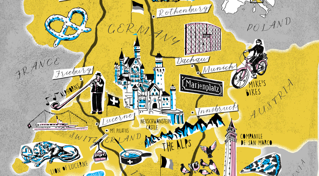
When my daughter went on a class trip to Europe this past summer, it was her first time there. She made so many amazing memories in Germany, Austria, Italy and Switzerland, I was so jealous! Of course like anyone would, she took tons of photos. But most of them live on her phone or in the cloud. And photos alone can’t capture the totality of an adventure like that. But an illustrated map can! I created this memory map for her as a way to record the overall experience of that trip — where she went, what she saw, things she did, where she stayed, foods she liked. It’s not only a cool way to trigger fond memories, it’s also a beautiful piece of art to hang in our home! Interested in having a map made of your own special trip or vacation? Contact me and let’s get started!
Read More ›