

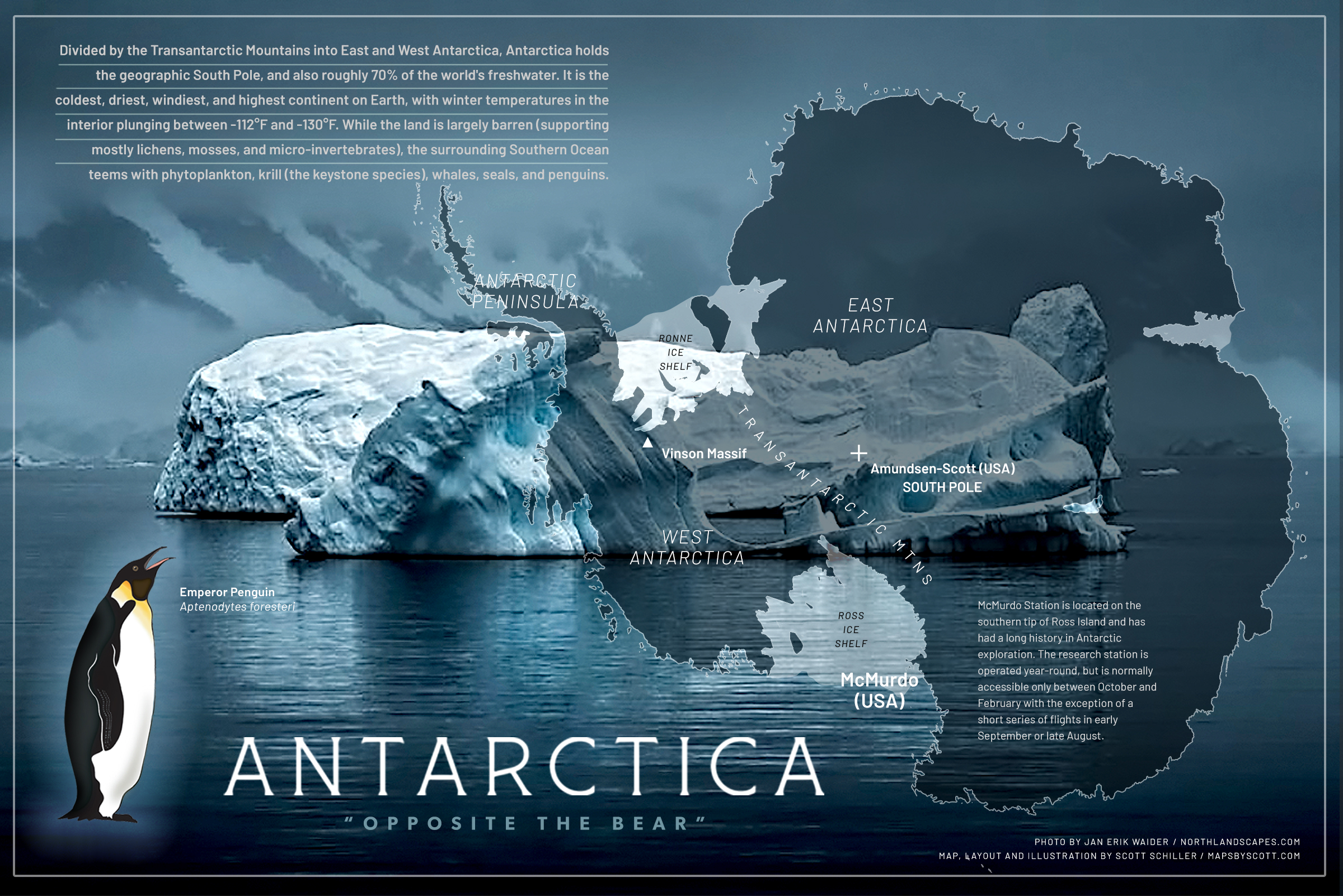
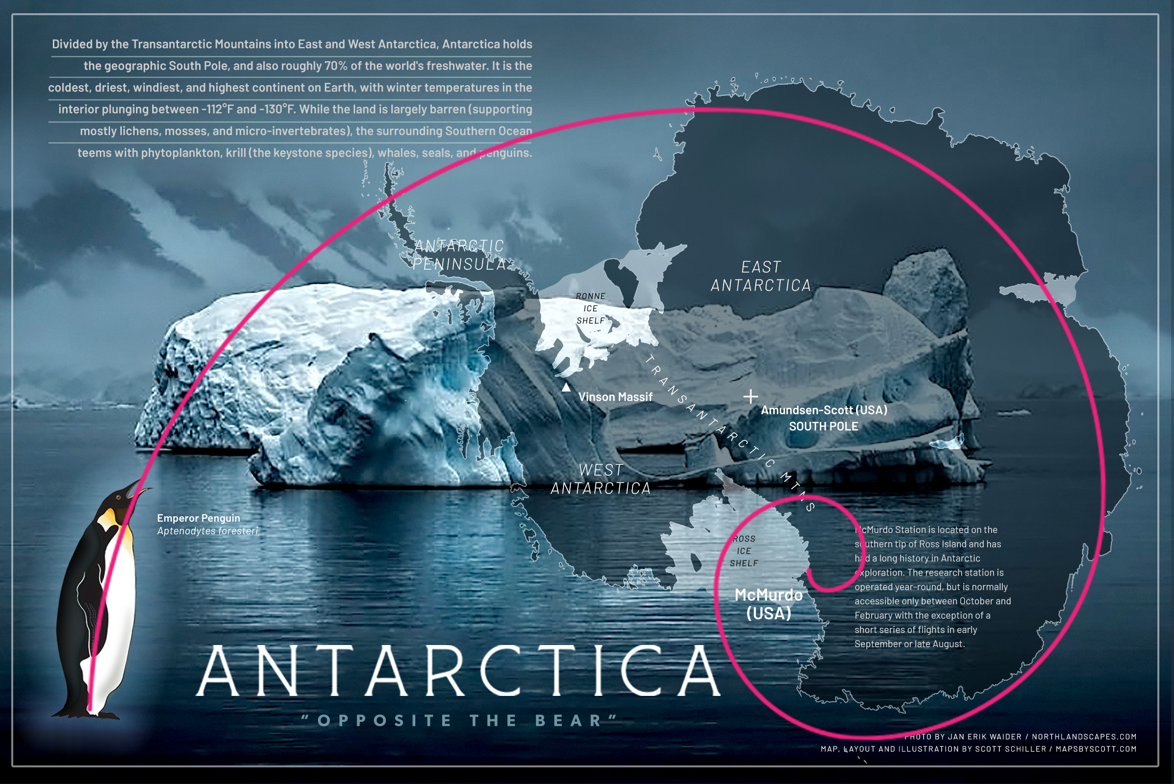
In this work I placed a map overlay over an amazing photo by Erik Jan Waider (www.northlandscapes.com), along with my illustration of the Emperor Penguin, the largest penguin species on the continent, and on the planet. This is another example of how a map can integrate with other imagery, transporting the viewer to another place while also communicating information that is informative, educational and entertaining. A Golden Spiral is evident in the layout, leading the eye from the penguin to the peninsula and the descriptive text, then hugging the map contour and ending at McMurdo Station (USA) . The spiral endows structure, balance and energy to the overall layout.
Antarctica (from Greek, antarktis, means “opposite the bear”) is the coldest, driest, windiest and highest continent on earth. It is also the most enigmatic, which explains why it has over 70 to 80 research stations and bases operated by roughly 30 different countries under the Antarctic Treaty System. McMurdo Station (USA) is the largest, supporting up to 1,200 people during the summer season, dropping to fewer than 200 during the dark Antarctic winter.