Missouri’s Katy Trail
Missouri Life Magazine published a coffee table-style hardcover book highlighting the famous Katy Trail and Rock Island Trail State Parks. With a hand-painted watercolor base and over 50 digitally-created, hand-drawn custom illustrations, this turned into one of my largest (and best) projects. It was a pleasure to work with the creative director, Dan Bishop, and the author Dan Burkhardt, to create this one-of-a-kind illustrated map showcasing some of the most famous landmarks, points of interest, historical markers and native flora and fauna that can be seen along the way or nearby. A duotone version of the map is featured on the front and back endpages. The book, titled Trails Across Missouri: The Katy and Rock Island, was published in August 2024 and can be ordered from Mr. Burkhardt’s website, MagnificentMissouri.org. Following release of his book, I worked with Mr. Burkhardt to create a design (below) of select illustrations from the map, to print on canvas tote bags.
Read More ›
Best of the World – Road Trips II
I was hired by National Geographic to create 15 original illustrated maps for the book, Best of the World: 1,000 Destinations of a Lifetime. The base of each map began as a watercolor painting, which I then digitized and modified in Photoshop. Illustrations were made in Procreate. Here are 3 more from that collection. This book can be ordered on Amazon here and also at Penguin RandomHouse here.
Read More ›
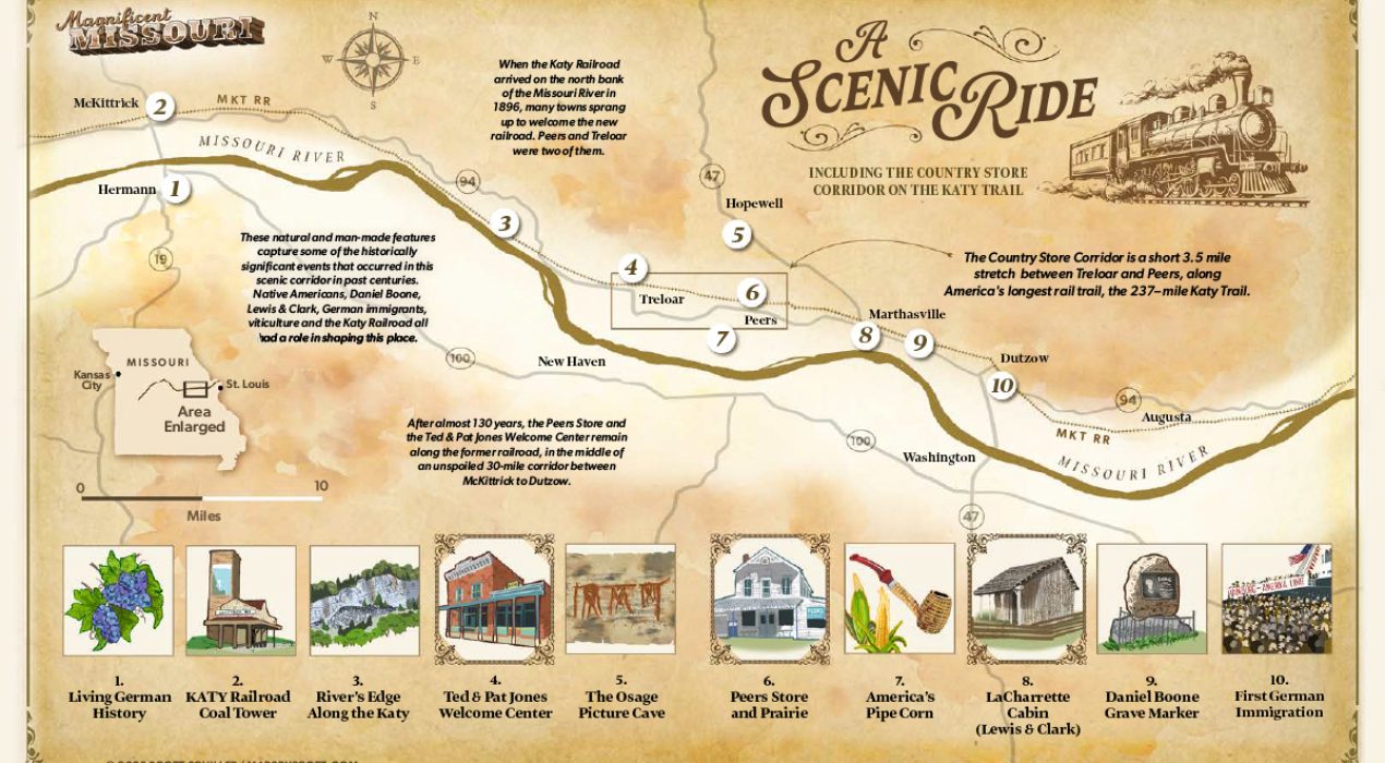
MKT Railroad, Missouri
This is an illustrated map showing a close-up of the MKT Railway between Augusta and McKittrick, Missouri, circa 1896. This historic railroad has since been converted to the nation’s longest rail-to-trail biking route (237 miles), spanning the entire state of Missouri. Watercolor base, muted color palette and vintage typography helps give this map the vintage/historic feel requested by the client for a book project.
Read More ›
error: Content is protected!