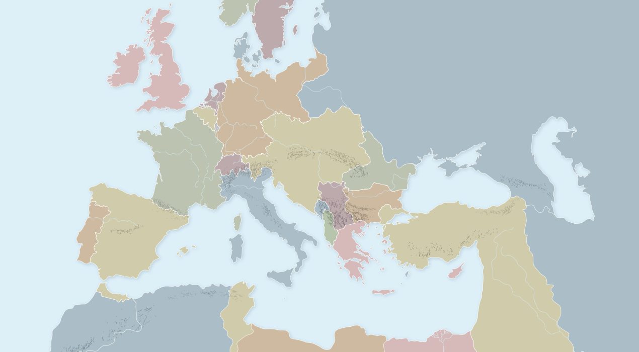
1914 Europe
Map of 1914 Europe on the eve of World War I, depicting nations and empires throughout the continents of Europe, Africa and western Asia. This map was created for a computer game backdrop. Major rivers and mountain ranges included, labels were intentionally left off.
Read More ›
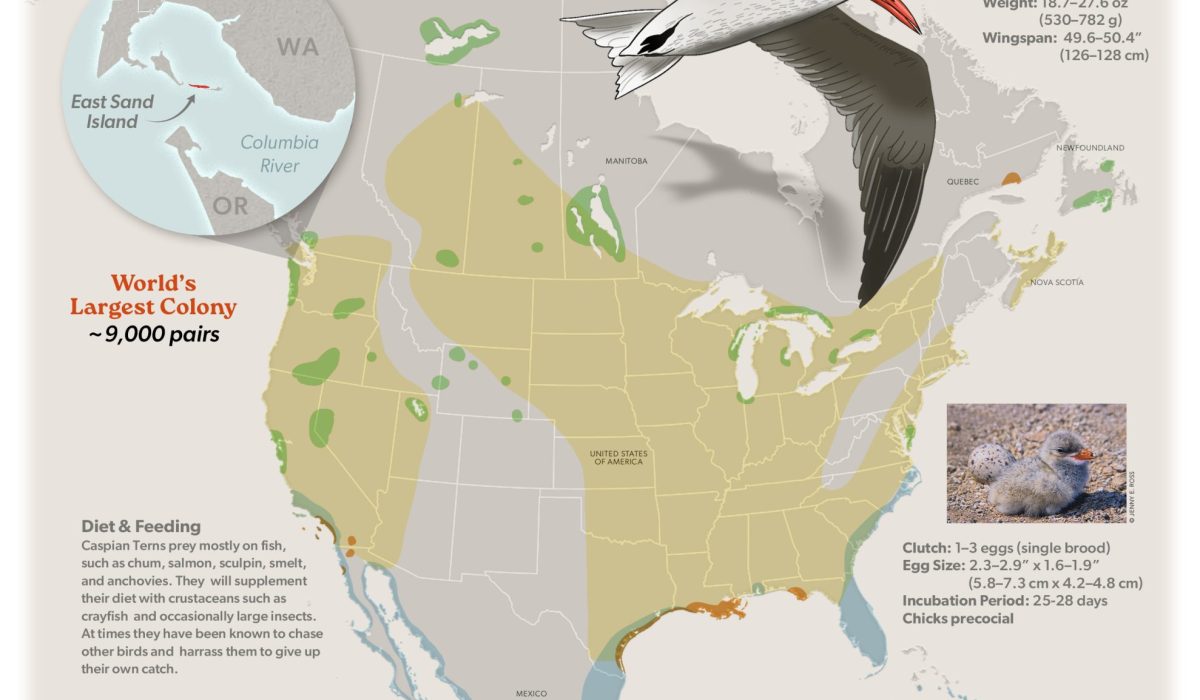
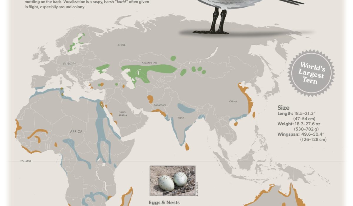
Caspian Tern Migration
Migratory maps are essential for the birding enthusiast and ornithologist. Such maps have been invaluable for helping me to identify species in a given area and season. Here are two I created in celebration of International Migratory Bird Day 2025. I chose the world’s largest tern, the Caspian Tern, for this migratory map.
Read More ›
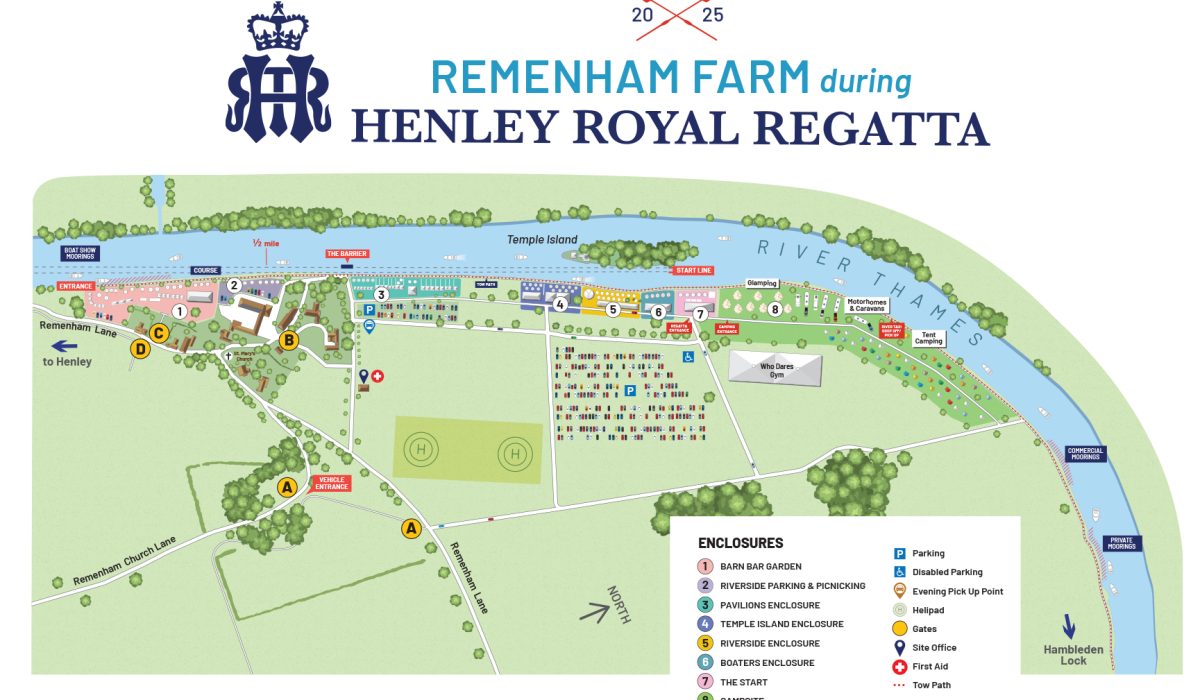
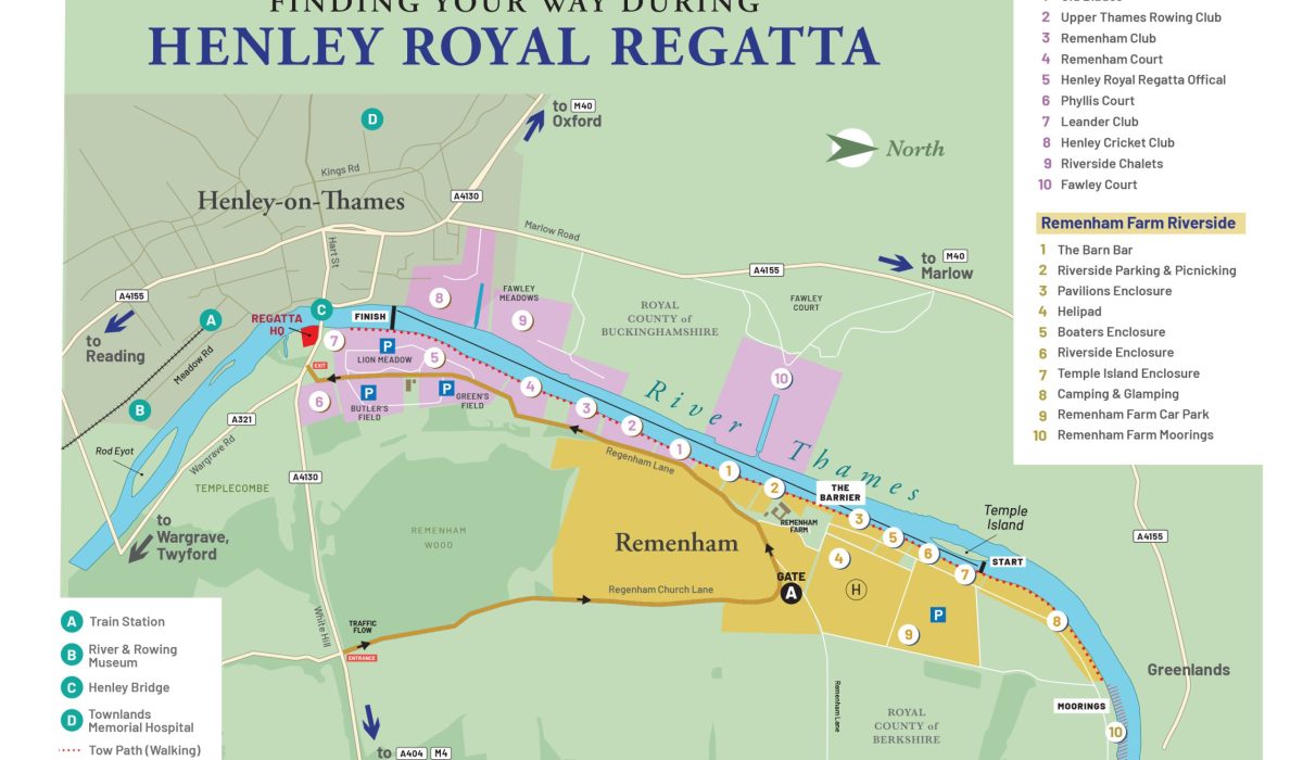
Henley Royal Regatta
Henley Royal Regatta is a 6-day rowing event on the River Thames held every July by the town of Henley-on-Thames, England. It was established in 1839. I was asked to create 2 maps for the event: one of Remenham Farm and Temple Island, where the race begins; and another of the wider view for navigation around the region, including the town of Henley-on-Thames, and depicting all venues along the river, from the race’s start to finish.
Read More ›
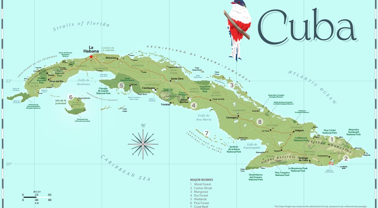
Parks of Cuba
I created this map for an upcoming edition of The Annotated Checklist of the Birds of Cuba by Nils Navarro. The map is intended to allow birders to chart their route around the island and it’s many birding hotspots. They can mark up the map with notes of their favorite sightings and locations.
Read More ›
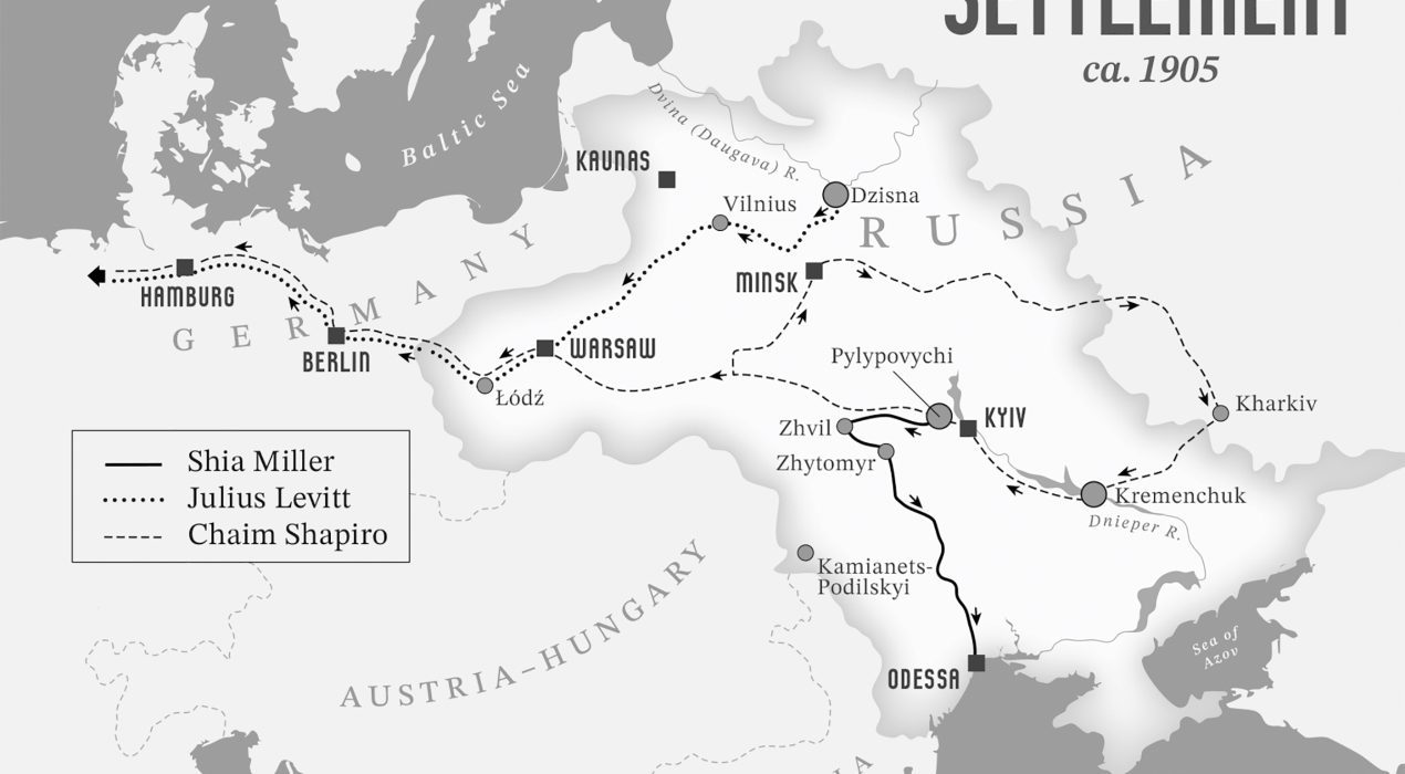
European Emigration early 1900s
This is a map plotting the journeys of 3 individuals emigrating from eastern Europe to New York USA, circa 1905. It is one of 5 maps commissioned by the Labor Studies Department at the University of California-Los Angeles for a book project about the Yiddish-speaking Jewish diaspora in early 1900s Los Angeles. The maps required intensive historical research into the roadways, railways and parks of downtown LA, from 1900 to 1930.
Read More ›
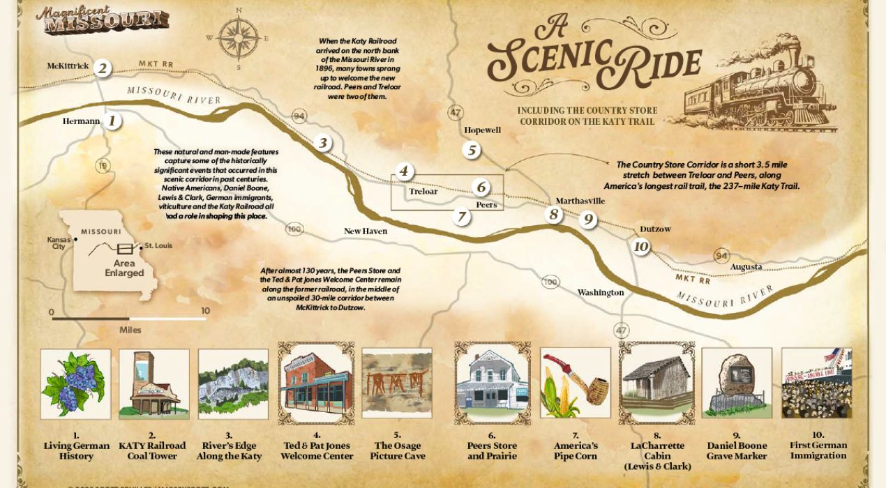
MKT Railroad, Missouri
This is an illustrated map showing a close-up of the MKT Railway between Augusta and McKittrick, Missouri, circa 1896. This historic railroad has since been converted to the nation’s longest rail-to-trail biking route (237 miles), spanning the entire state of Missouri. Watercolor base, muted color palette and vintage typography helps give this map the vintage/historic feel requested by the client for a book project.
Read More ›
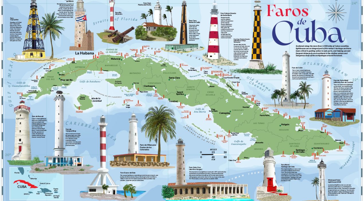
Lighthouses of Cuba
The island of Cuba has a long maritime history, and consequently, there are more than 50 lighthouses scattered along the more than 3,500 miles of coastline. This map has illustrations of 16 of the most familiar towers, as well as others named and located around the island. It is incredible that these structures are still standing despite decades of direct hits by intense hurricanes and tropical storms. Their importance as aids to mariners through the narrow channels and shallow reefs cannot be overstated.
Read More ›
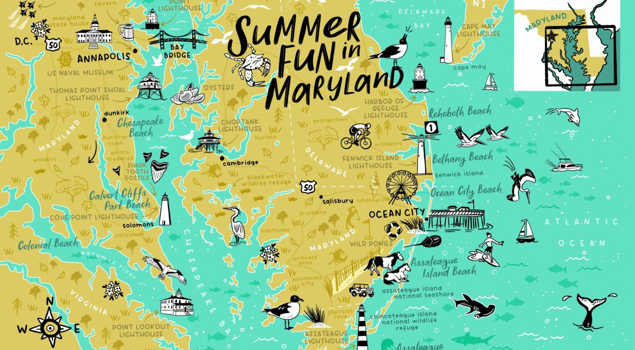
Ocean City MD
A vacation on the East Coast is always a treat, there is so much to do! You can check out the pier at Ocean City, the wild ponies at Assateague Island, the lighthouses of Chesapeake Bay, the shops and historic taverns of Annapolis. And oh my, all of the delicious blue crab and oysters!
Read More ›
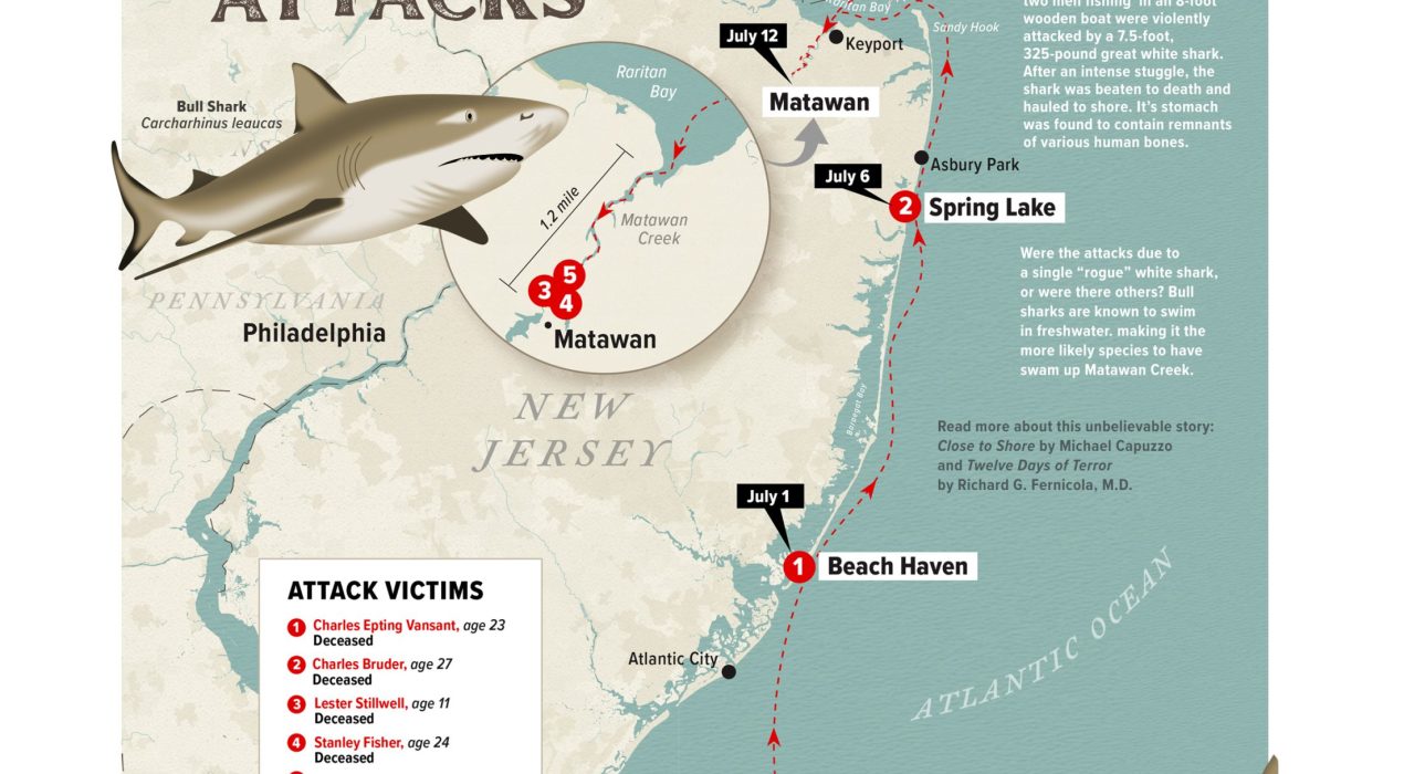
1916 NJ Shark Attacks
I was inspired to create this map after reading the book, Close to Shore, by Michael Capuzzo, based on the incredible true story of the New Jersey shark attacks of 1916. All but one of the five attacks were fatal. The only other map I found online was lacking in detail and character, so I decided to make one myself. I wanted to highlight the timeline and locations of each of the incidents, with a better view of the region around Matawan, where a shark traveled more than a mile up a shallow muddy creek. I illustrated two shark species, the white and the bull, because (even to this day) there is debate about which of the two, or both, were responsible for the attacks. Bull sharks are known to swim in fresh water, making it the most likely suspect in the Matawan attacks. After a giant great white was captured and killed on July 14, there were no more attacks. Note: though these shark attacks were gruesome in nature, my map is not intended to be sensationalistic or to malign sharks. Rather, I simply felt a better map was needed to represent these historic events. Personally, I have profound […]
Read More ›
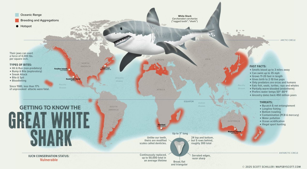
Great White Shark
For this year’s Shark Week I created an infographic-styled map for the great White Shark. This is, without question, the most misunderstood and feared of all the world’s shark species. Even though this graphic points out a number of interesting facts and figures about this apex marine predator, there is SO much more that we simply do not know. But with dedication to increased research and focused conservation, further knowledge can lead to greater awareness, which can replace fear with fascination, and foster empathy for this animal. Here are just a few of the organizations worldwide devoted to the great White, and other, shark species: Atlantic White Shark Conservancy Shark Stewards Sea Shepherd Conservation Society Shark Trust Shark Angels
Read More ›
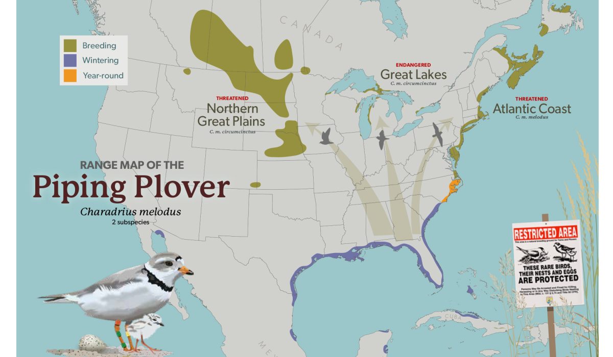
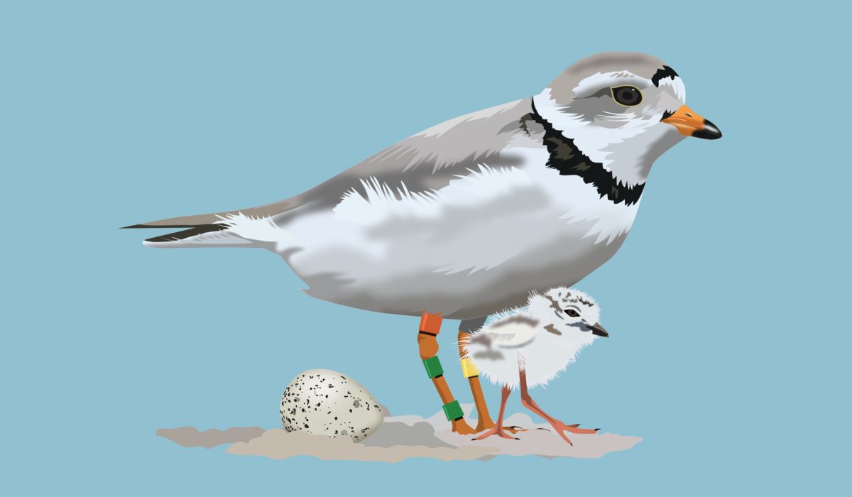
Piping Plover Range
I made this map as a working draft for a future infographic about the adorable little shorebird, the Piping Plover. This project combines my love of birds, conservation, beaches, and, of course, maps. Piping Plovers require safe, clean beaches to breed and raise their puffball chicks, but as these same places are popular with people there is the inevitable clash of Us vs. Them. Protective measures to help increase populations of this species, such as fencing off nesting areas and limiting beach access during nesting season, are essential for this bird’s continued survival. On behalf of Piping Plovers everywhere, please…Share the Shore! More info: American Bird Conservancy US Fish & Wildlife Service National Audubon Society
Read More ›
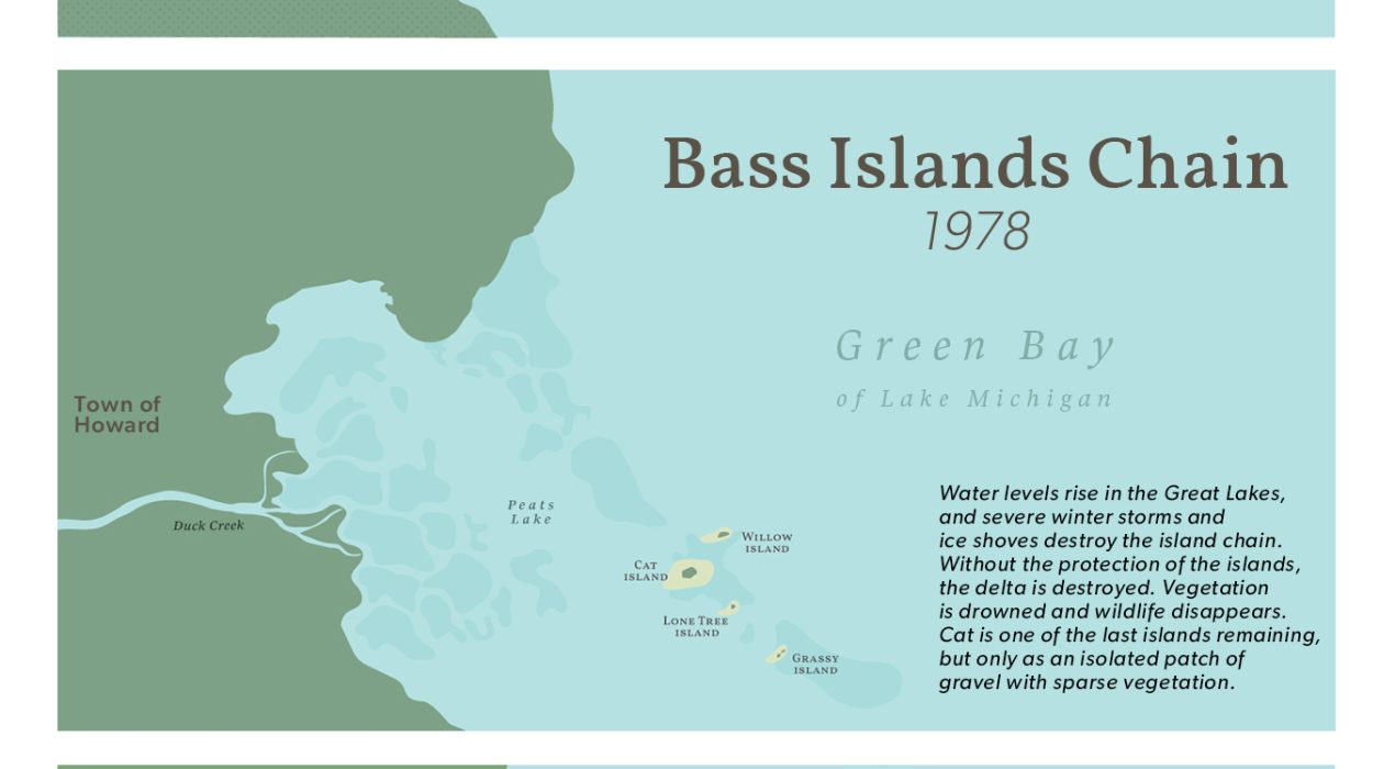
Cat Island Chain
Lake Michigan’s Green Bay is the largest freshwater estuary in the world. In 2012, a massive undertaking began in the southern end of the bay — rebuilding the barrier island chain that disappeared beneath the waves in the late ’70s. The Cat Island Chain Restoration Project will take another 30 years to complete, but already the hard work is paying off: as the three islands (“cells”) are filled with clean sand and gravel, wild rice and wild celery are being replanted and endangered piping plovers have returned to nest in the area. These three maps show a 75-year span of this region: 1) the former barrier islands and delta, 2) the effects on the islands from rising lake levels and severe storms, and 3) the progress of the rebuilding process (as of 2024). Learn more about this massive ecological restoration project here.
Read More ›
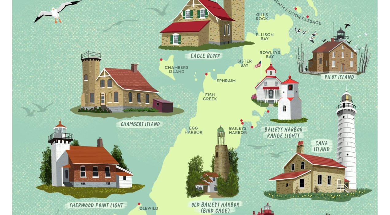
Lighthouses of Door Peninsula
Door County makes up the largest segment of Wisconsin’s famous peninsula and is one of my favorite summer getaways. Door County has the most lighthouses (11), the most miles of shoreline (250), and the most state parks (5) of any county in the contiguous United States! It is also the location of the infamous “Death’s Door Passage”, one of the reasons why there are so many lighthouses concentrated there. My illustrated map includes a few more lighthouses that can be found on the greater Door Peninsula. National Lighthouse Day is on Aug. 7 and some of these lighthouses offer special access inside (they are otherwise off-limits to the public).
Read More ›
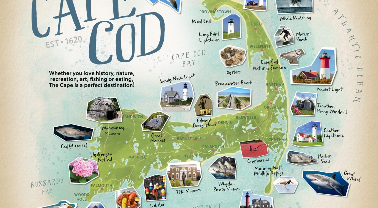
Cape Cod
Cape Cod, Massachusetts, is a vacation wonderland, rich in maritime history, natural beauty, pristine beaches and fabulous seafood. The client for this project wanted a bit of a scrapbook-y feel, so I used small photo thumbnails instead of hand drawn illustrations. I think the effect is quite nice!
Read More ›
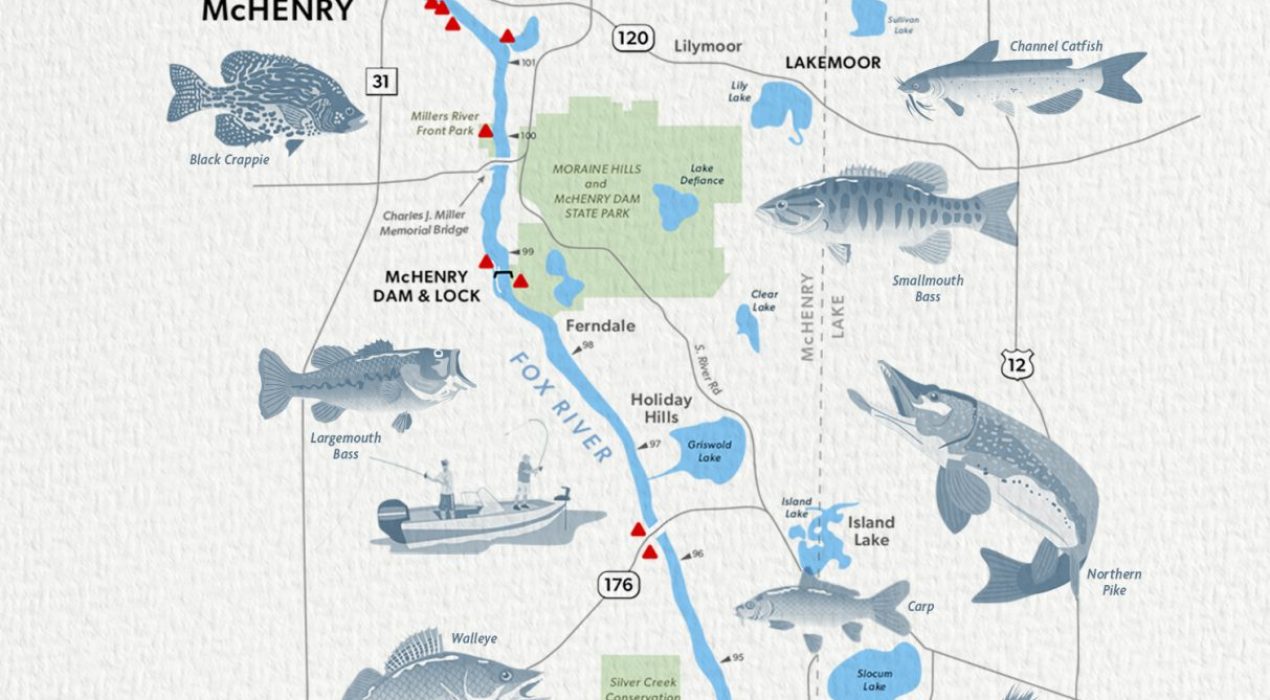
Fox River – Illinois
My client needed a custom map to print and market to boaters and anglers who frequent this portion of the river between the towns of Fox Lake and Algonquin. The map can be used with or without illustrations, but I think the fish with ID labels make it more visually appealing and informative. This is an unfinished draft — it still needs the list of business names to go with the red locator triangles along the route. I can envision a set of maps like this one that would cover the total length of the Fox River. The Fox River flows for 115 miles southward from its headwaters in Waukesha, Wisconsin to its confluence with the Illinois River in Ottawa, Illinois. It is one of the most versatile bodies of water to fish in Illinois, with 13 dams and over 100 public access points, making it very popular for fishing. The waters around the McHenry Lock & Dam provides provides more walleye than any other spot on the river and is a prime area for channel catfish, white and yellow bass, and crappie
Read More ›
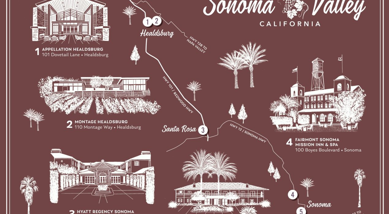
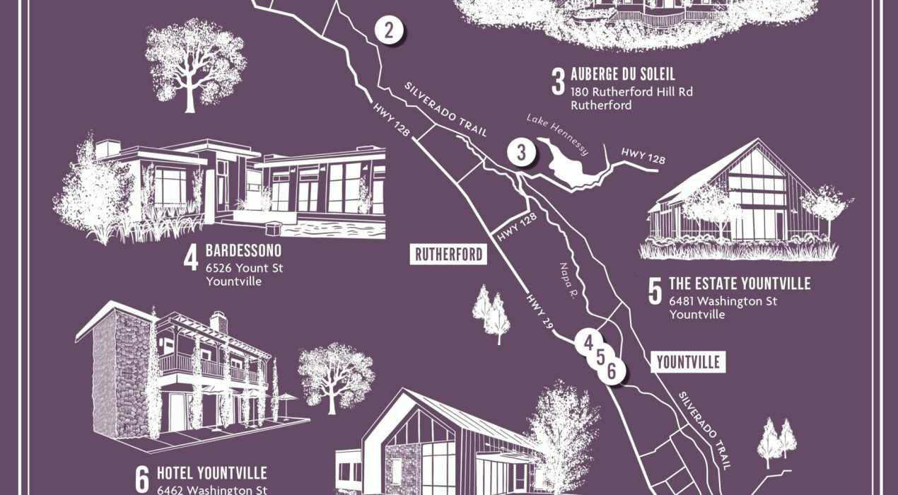
Napa Valley, CA
“At only 30 miles in length and 5 miles across at its widest point, California’s Napa Valley is a unique wine-growing region with a complex tapestry of vineyard locations that possess unique, individual personalities through soil and climate.” [Source: napavintners.com] Here I’ve drawn a simple line map of the major roads weaving throughout the valley, from Calistoga in the north, through Rutherford in the central valley, to the town of Napa in the south. The valley has around 400 wineries, as well as a wide variety of luxury resorts, hotels and spas. My client requested I also include detailed illustrations of 7 different properties they associate with.
Read More ›
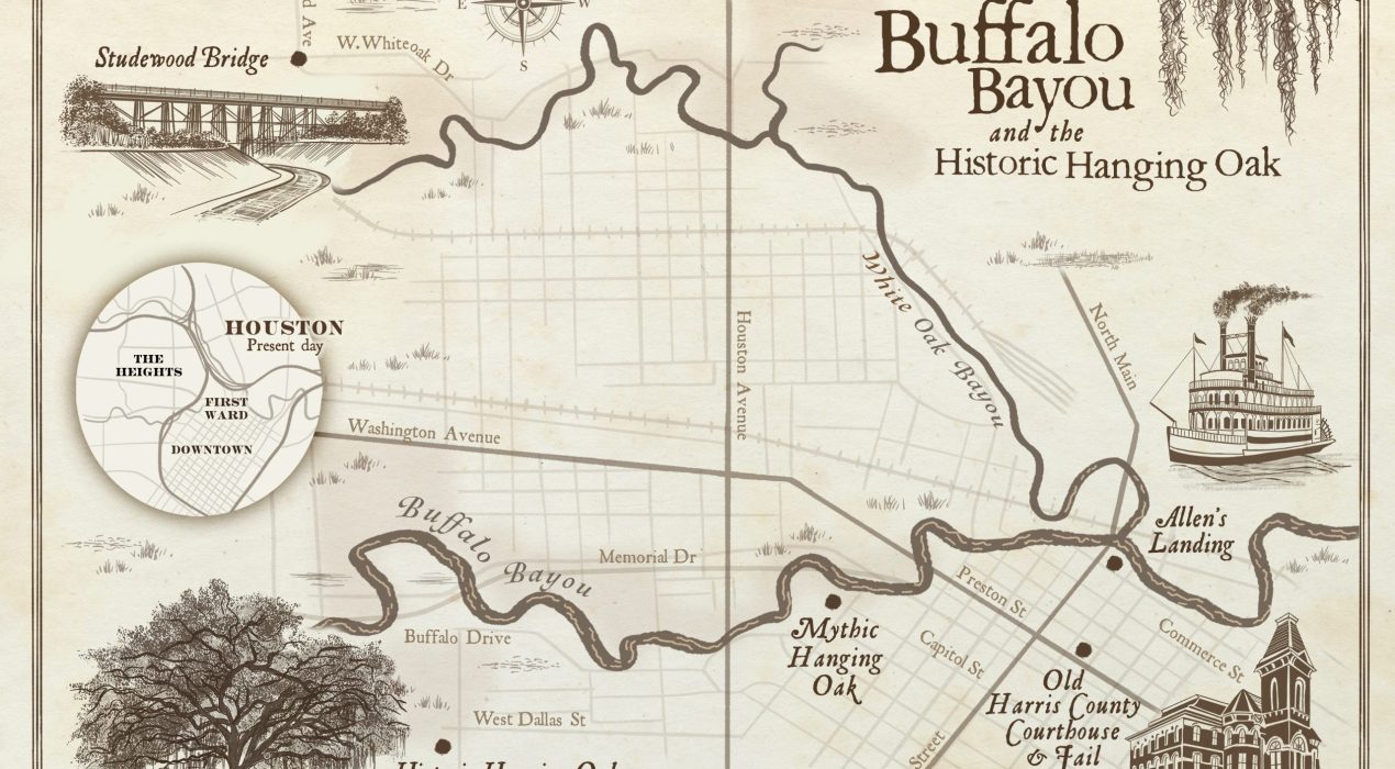
Buffalo Bayou, TX
Illustrated map of area where Buffalo Bayou and White Oak Bayou meet, the historic location of the founding of Houston, Texas. Commissioned for a forthcoming non-fiction book by Poseidon Publishing, LLC.
Read More ›
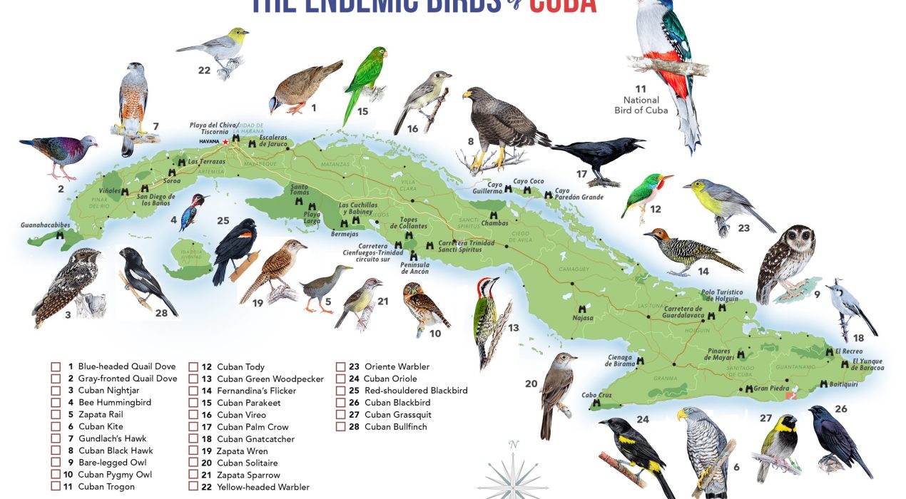
Endemic Birds of Cuba
For the 6th year I have been assisting in the cover design of the “Annotated Checklist of the Birds of Cuba“. For 2026 I proposed the addition of a map, as a visual aid for birders who travel around the island, led by birder, naturalist and resident avian illustrator Nils Navarro. This map has been adapted from the original map of The National Parks of Cuba I made here. His field guide illustrations are used with permission, taken from his book, “Endemic Birds of Cuba: A Comprehensive Field Guide” (© 2015). Binocular icons represent important birding locations and hot spots.
Read More ›
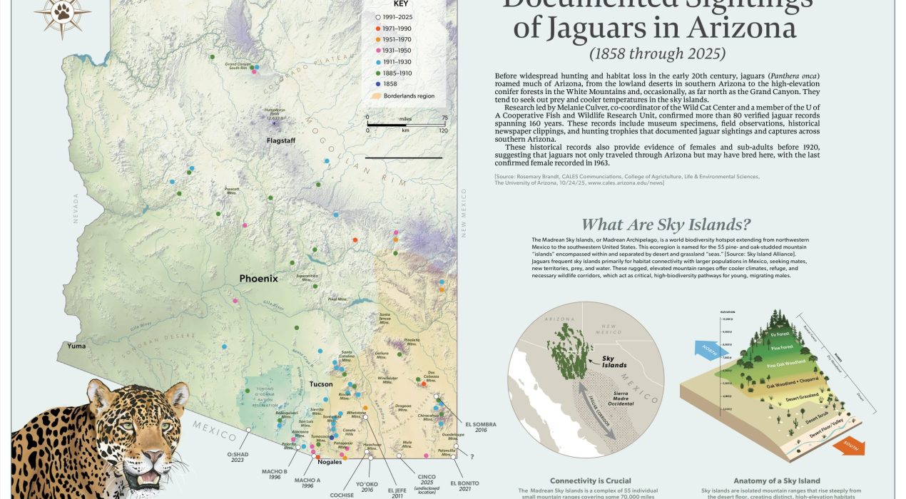
Jaguars in Arizona
Jaguars once roamed much of Arizona, even as far north as the Grand Canyon. Today, in spite of illegal hunting, habitat loss, a human population explosion and more than 370 miles of border wall, jaguars still wander into the state, but not much farther than just north of the US-Mexico border. The most recent sighting of a jaguar in Arizona, named “Cinco”, was in December 2025. In this map I plotted the historic documented sightings of this magnificent cat, to better visualize the relationship between those locations with what are known as “sky islands.” To understand how and why jaguars travel into Arizona we first need to appreciate the importance of those sky islands, which is why I added the locator map and small infographic. All illustrations are my own. To learn more, I highly recommend reading “Heart of the Jaguar: The Extraordinary Conservation Effort to Save the America’s Legendary Cat,” by James Campbell (Norton Publishing © 2025). It was this book that inspired this map. Available on Amazon.
Read More ›
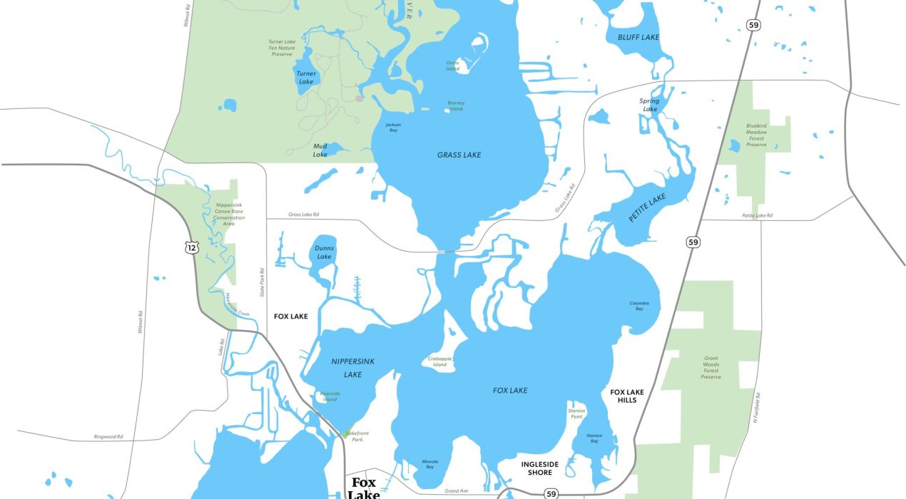
Chain O’ Lakes
This is a custom map I created for a future map designed to show handicapped-accessible boat ramps, docks and marinas, along with various shops, pubs and restaurants. The client wanted a map that was up-to-date, crisp, uncluttered and editable for his particular needs. The Chain O’Lakes, or simply “The Chain”, is a waterway system in northeast Illinois composed of 15 lakes connected primarily by the Fox River (45 miles) and Nippersink Creek, with many man-made channels. The chain is a remnant of the retreating glaciers around Encompassing more than 488 miles of shoreline and 45 miles of river, the Chain is the busiest inland recreational waterway per acre in the United States. [Source: Wikipedia] It accommodates a wide range of outdoor recreational activities, including boating, kayaking, canoeing, hunting, fishing, birdwatching, swimming, water skiing, and tubing.
Read More ›
error: Content is protected!