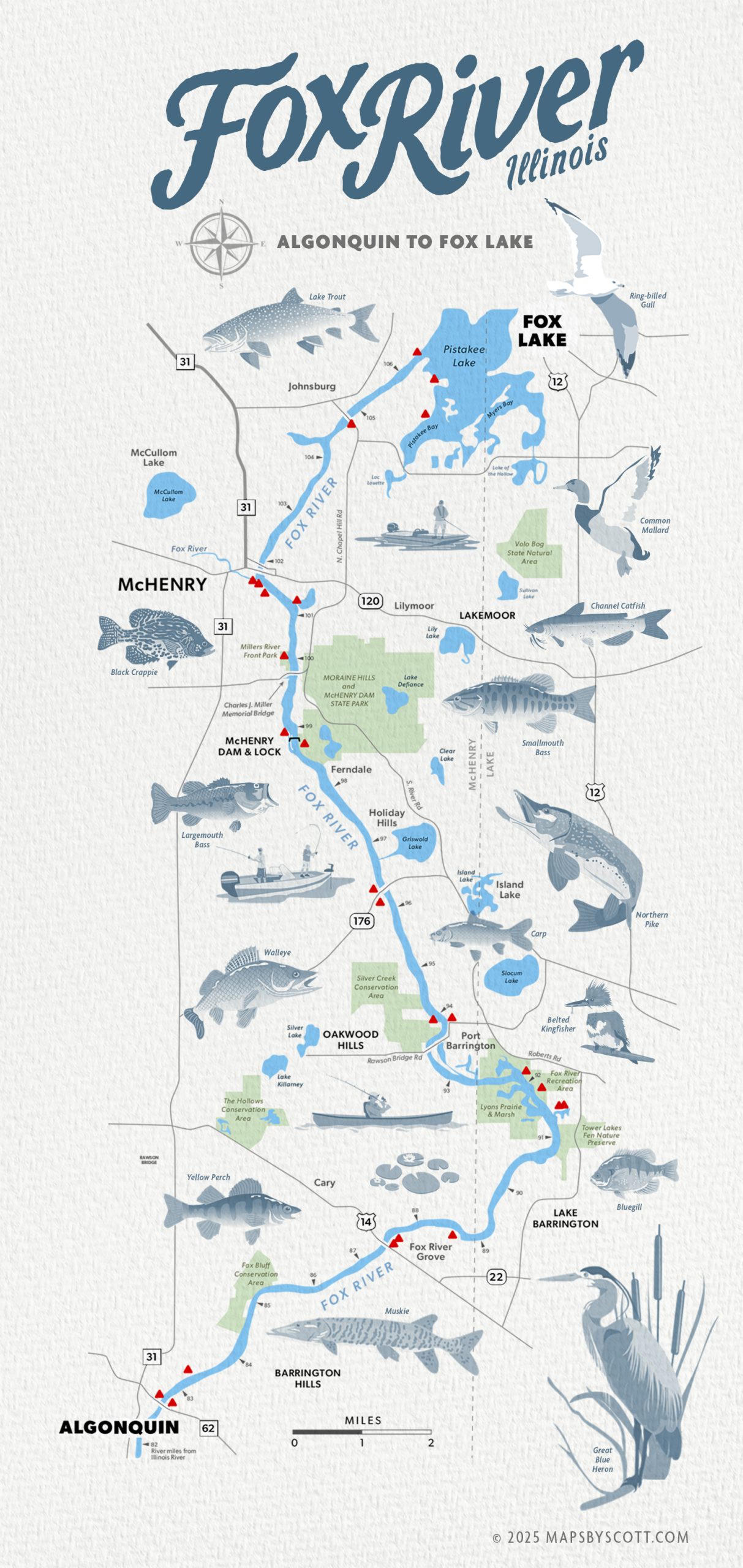
My client needed a custom map to print and market to boaters and anglers who frequent this portion of the river between the towns of Fox Lake and Algonquin. The map can be used with or without illustrations, but I think the fish with ID labels make it more visually appealing and informative. This is an unfinished draft — it still needs the list of business names to go with the red locator triangles along the route. I can envision a set of maps like this one that would cover the total length of the Fox River.
The Fox River flows for 115 miles southward from its headwaters in Waukesha, Wisconsin to its confluence with the Illinois River in Ottawa, Illinois. It is one of the most versatile bodies of water to fish in Illinois, with 13 dams and over 100 public access points, making it very popular for fishing. The waters around the McHenry Lock & Dam provides provides more walleye than any other spot on the river and is a prime area for channel catfish, white and yellow bass, and crappie